
Archives
Enter a word or phrase to perform a general search across all records in the Archives catalog. You can also browse records in the catalog without performing a search.
Search Tips
- Searches are not case sensitive.
- Searching for multiple words connects them with OR by default. Matching records can contain any of the words.
- Connect multiple words with AND if you only want to see records containing both words.
- Use quotation marks to search for a phrase.
- Place an asterisk (*) at the end of a word as a wildcard.
1210 results found sorted by relevance. Records searched: 1210
-

-
-
-
-
-
-
2019.007.001 - Punta Gorda and Charlotte County Chamber Visitors Guides
Pamphlet
Record Type: Archive
-
-
-
-
-
-
-
-
-
-
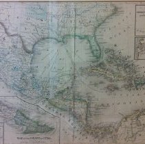
2015.002.024 - Colored map of Mexico, Central America and the West Indies. Constructed and Engraved by W. Williams. Dimensions: 11.5" x 19.5"
Map
Record Type: Archive
-
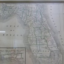
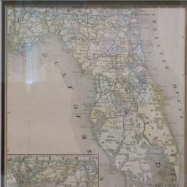
2015.002.027 - Colored map of Florida, Section VI, with insert of St. John's River and Port Charlotte. Dimensions: 22" x 18"
Map
Record Type: Archive
-
-