
Archives
Enter a word or phrase to perform a general search across all records in the Archives catalog. You can also browse records in the catalog without performing a search.
Search Tips
- Searches are not case sensitive.
- Searching for multiple words connects them with OR by default. Matching records can contain any of the words.
- Connect multiple words with AND if you only want to see records containing both words.
- Use quotation marks to search for a phrase.
- Place an asterisk (*) at the end of a word as a wildcard.
1210 results found sorted by relevance. Records searched: 1210
-
-
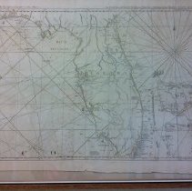
2015.002.005 - 1775 Map of the coast of west Florida and Louisiana. From Thos Jefferys, Geographer to His Majesty.
Map
Record Type: Archive
-
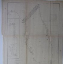
2015.002.007 - US Geological Map VI of Tampa Bay and Charlotte Harbor 1848 - 1852
Map
Record Type: Archive
-
2015.002.008 - 1794 Colored map of the West Indies. Dimensions: 18.75" x 33.75".
Map
Record Type: Archive
-
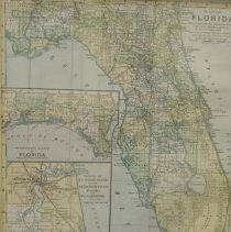
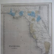
2015.002.014 - Map of Florida Counties with insert of Jacksonville. Dimensions: 9" x 12"
Map
Record Type: Archive
-
-
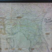
2015.002.018 - Colored map of the plant system of railways, steamer and steamship lines for Florida and Cuba. Issued by the Associated Railway Land Department of Florida, H.B. Plant, President. Dimensions: 19" x 22"
Map
Record Type: Archive
-
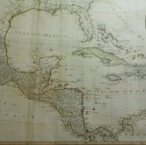
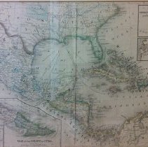
2015.002.024 - Colored map of Mexico, Central America and the West Indies. Constructed and Engraved by W. Williams. Dimensions: 11.5" x 19.5"
Map
Record Type: Archive
-
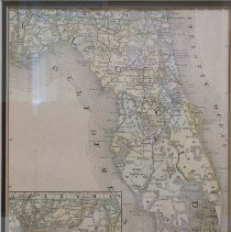
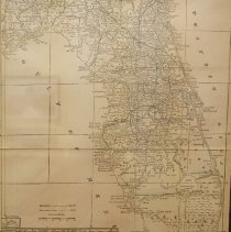
2015.002.027 - Colored map of Florida, Section VI, with insert of St. John's River and Port Charlotte. Dimensions: 22" x 18"
Map
Record Type: Archive
-
2015.002.060 - Early map of Florida with naming of early counties from The World Atlas. Dimensions: 16" x 13"
Map
Record Type: Archive
-
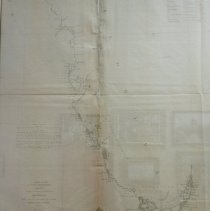
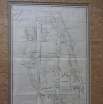
2015.002.109 - Map of the Peninsula of Florida show the present field of surveying in the territory. Dimensions: 10.75" x 18"
Map
Record Type: Archive
-
-
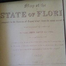
2015.002.142 - Photocopy of caption to Florida map prepared by Jefferson Davis
Map
Record Type: Archive
-

-
2015.002.171 - Blueprint of Blocks 25 - 28 Cleveland Township, Charlotte County. Issued for the Federal Realty and Deelopment Com., Ft Myers, Florida. Dimensions: 25" x 32"
Map
Record Type: Archive
-
2015.002.176 - Photocopy of map of Little Sarasota Bay. (Portion of a larger map). Dimensions 23" x 44"
Map
Record Type: Archive
-
2015.002.181 - Topographical map T-5874 of Charlote Harbor & Vining Creek, south of Burnt Store,Dimensions: 32" x 47"
Map
Record Type: Archive
-
2015.002.182 - Topographical map of Fort Ogden in a quadrangle of DeSoto County. (Peace River located on left margin of map). Dimensions 23" x 27"
Map
Record Type: Archive
-
2015.002.188 - Reprint by Max Cleland, Secretary of State (1979) of a 1777 map of Colonial Georgia with identifiaction fo Parishes along the Atlantic Coast. Dimensions: 15" x 18"
Map
Record Type: Archive
-
2015.002.199 - Map of Devil's Garden Road in relation to Fort Keais with notation fo "countless herds of deer and cattle" Taken from Township Map 45S, R32E. Dimensions: 18" x 24"
Map
Record Type: Archive